


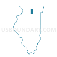
CLINTON 2 Voting District, DeKalb County, Illinois
About
Outline

Summary
| Unique Area Identifier | 569973 |
| Name | CLINTON 2 Voting District |
| County | DeKalb County |
| State | Illinois |
| Area (square miles) | 18.22 |
| Land Area (square miles) | 18.19 |
| Water Area (square miles) | 0.03 |
| % of Land Area | 99.85 |
| % of Water Area | 0.15 |
| Latitude of the Internal Point | 41.76532630 |
| Longtitude of the Internal Point | -88.73966690 |
Maps


Graphs
Select a template below for downloading or customizing gragh for CLINTON 2 Voting District, DeKalb County, Illinois


Neighbors
Neighoring Voting District (by Name) Neighboring Voting District on the Map
- AFTON 1 Voting District, DeKalb County, IL
- CLINTON 1 Voting District, DeKalb County, IL
- PIERCE 1 Voting District, DeKalb County, IL
- SQUAW GROVE 2 Voting District, DeKalb County, IL
- VICTOR 1 Voting District, DeKalb County, IL
Top 10 Neighboring County Subdivision (by Population) Neighboring County Subdivision on the Map
- Squaw Grove township, DeKalb County, IL (2,802)
- Clinton township, DeKalb County, IL (1,868)
- Afton township, DeKalb County, IL (861)
- Pierce township, DeKalb County, IL (454)
- Victor township, DeKalb County, IL (299)
Top 10 Neighboring Place (by Population) Neighboring Place on the Map
Top 10 Neighboring Unified School District (by Population) Neighboring Unified School District on the Map
- Hinckley-Big Rock Community Unit School District 429, IL (4,862)
- Indian Creek Community Unit District 425, IL (4,690)